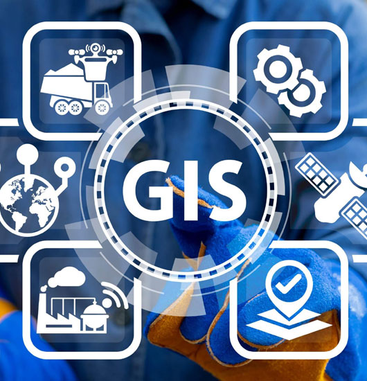
main

GEOGRAPHIC INFORMATION SYSTEMS

 
Geographic Information Systems (GIS) and geospatial data have a significant impact on businesses, governments, and communities worldwide. Location data plays a crucial role in global economic activity, contributing to billions of dollars in GDP every year. However, its importance is often overlooked as it is deeply integrated into our society. At Meganomix, GIS is central to our vision and forms an essential part of our business. We recognize the vital role GIS plays in connecting societies and strive to promote its benefits through our geospatial data services and solutions. Our skilled GIS teams work tirelessly to ensure the accuracy and precision of the data used in GIS and geospatial analysis, understanding that the quality of input data directly influences the reliability of results. We are committed to providing services with complete, up-to-date, and error-free data to help make informed decisions through interactive maps and valuable insights.

Effective use of smart location data has become a valuable asset for gaining a competitive advantage. By analysing spatial patterns and trends, organisations can predict future opportunities or risks and gain actionable insights to maximise benefits or minimise potential issues. This kind of spatial analysis also leads to immediate cost savings through accurate and efficient decision-making. Examples of transformative applications for GIS and geospatial data include land management, site selection, logistics routing, utility mapping, facility management, infrastructure projects, network analysis, customer segmentation, and project monitoring.

At Meganomix, we offer a comprehensive range of GIS services, from 2D mapping to photogrammetry, LiDAR, and BIM, to meet your evolving business needs for precise location intelligence, trend analysis, demographics, and valuable insights for visualisation and interpretation. Our geospatial data services are software-neutral, supporting both proprietary GIS technology like ESRI and open-source alternatives like QGIS. This flexibility allows us to cater to a wide range of geospatial data inputs, outputs, and formats, and we can develop in-house GIS software applications when needed.

Our services span various domains, including mining, real estate, logistics, infrastructure, transport, commerce, government, retail, forestry, and agriculture. As one of India's top 20 multi-disciplinary GIS service providers, we stand out for our integrated services and solutions that utilise GIS, LiDAR, and BIM technologies. Our GIS specialists leverage advanced technology and extensive research to deliver the support and accuracy necessary for critical decision-making and business growth through smart visualisations, comprehensive insights, data analysis, and smart maps. We have a proven track record in AV data processing and have successfully executed numerous projects for large insurance and mining companies in this field.


GIS Consulting Services

 
Meganomix is a global information services provider that specialises in offering geospatial services, revolutionising various industries through a unique combination of critical location intelligence, intelligent location-based analytics, proprietary solutions, strong operations, and innovative business engagement models. Our journey began in 2007, initially serving clients' photogrammetry mapping needs, but we have since grown to become a leading partner for enterprise transformation, providing specialised GIS consulting services. Our team of professionals is skilled in delivering customised GIS solutions to meet the location intelligence requirements of businesses of all sizes.

We take a consultative approach, understanding your specific business needs, and crafting a tailored geospatial strategy. Our GIS specialists have extensive experience in various industries, including telecom, transportation, urban planning, energy, agriculture, government, banking, and healthcare. Leveraging our acclaimed GIS expertise, we help clients harness the latest GIS capabilities, streamline workflows, optimise existing GIS systems, and gain a competitive edge.

Our geographic data systems consultants analyse GIS projects and applications to identify challenges and implement innovative solutions. We assist enterprises in getting the most out of their GIS applications, helping them understand new GIS software, and offering full-cycle GIS consulting services, from design and development to maintenance and support of their GIS products.


GIS Application Development

 
Meganomix is a leading provider of GIS services, specialising in the development and maintenance of GIS applications using the latest techniques and technology. We excel in delivering top-notch geospatial services by collecting and analysing precise location data for visualisation. Our highly skilled experts work closely with clients on various aspects of GIS applications, including development, systems integration, database and data development, and IT infrastructure, automating business processes, and enhancing overall performance.

We have extensive experience in addressing the end-to-end GIS application requirements of our clients, offering tailored services with customizable functionalities to meet the diverse GIS needs of international companies. Our infrastructure engineers possess the expertise to create accurate GIS applications with structured workflows, starting from requirement analysis, coding, to final deployment.

Our teams can assist with real-time data and network processing, management, and execution, adapting to the specific needs of our clients to provide customised services that meet their requirements. We have knowledgeable project managers who deliver high-quality GIS training to clients seeking to enhance their skills. Additionally, we offer training for various software packages like AutoCAD, QGIS, ArCGIS, ERDAS Imagine, FME, PostGIS, and PostgresQL.

In summary, we have the necessary knowledge and experience to provide accurate GIS application development services to our clients. By improving data flow, model design, feature identification, visualisation, and other services, we can help increase the efficiency of your organisation. We also support comprehensive data management and cross-platform migration.


Web GIS Development

 
As a leading provider of GIS application development services, we at Meganomix offer numerous business advantages that help our clients maintain a competitive edge. Our GIS services are cost-effective and customised to meet the specific needs and budget of each client. As a certified company, we prioritise the security and confidentiality of our clients' information, ensuring that only authorised team members have access to it.

Our infrastructure engineers work from various delivery centres worldwide, covering multiple time zones, enabling us to deliver high-quality services to clients promptly. Before delivering our services to clients, we subject them to a rigorous quality assurance process to ensure excellence.

For each client, we appoint a specialised project manager who serves as the single point of contact for solutions and queries. Our services are scalable and flexible, allowing us to adapt to changing project dynamics. We have the capabilities and experience to increase the number of resources and service requirements as needed by the client. This ensures that we can efficiently meet the demands of any project.


GIS Support Services

 
Having extensive experience working with companies of all sizes, we have developed the expertise to provide critical GIS data services and solutions that address the location intelligence needs of various industries. We simplify GIS data capture using advanced satellite imagery techniques and offer customizable GIS solutions to optimise spatial data analytics, reducing both cost and time.

Our solutions are customer-centric, and our proficiency with software like Esri, Trimble, Autodesk, and others allows us to offer unmatched domain expertise and scalable service models for different GIS applications. Whether it's digital twin creation, LiDAR point cloud modelling, Scan to BIM projects, elevation modelling, or extracting 3D features from aerial photography data or scanned maps, our experts handle it with skill and professionalism.

Additionally, we have developed GIS software solutions capable of capturing and processing large volumes of spatial data into structured geospatial databases using the derived spatial information. This ensures that our clients have efficient and organised access to their geographic data.


GIS Solutions

 
Meganomix offers advanced 2D mapping services that utilise numerous terrain images to create high-definition maps with exceptional precision. These maps provide clients with accurate terrain information for elevation models, object mapping, multispectral indices, and structural documentation, aiding them in making well-informed decisions. We collaborate with various industries, including E-commerce, agriculture, forestry, real estate, transportation, engineering, telecom, power, oil, gas, utility, roads, highways, disaster management, solid waste management, environmental consulting, and more.

Our integrated mapping services cater to both public and private organisations, enabling them to effectively leverage spatial intelligence in their workflows. To ensure optimal results, we gather data for 2D mapping using CAD, GIS, and GPS services, allowing us to deliver excellent outcomes regardless of the scale, be it a region, state, or nation. The dynamic 2D maps offer detailed information about properties, locations, and assets, aligning perfectly with industry-specific business needs.

Our 2D mapping services find extensive application in land surveys, mining, construction, development, farming, agriculture, and many other areas, providing businesses with crucial spatial data. We ensure that our clients have access to the most critical and relevant information by providing accurate terrestrial LiDAR survey data. With LiDAR technology, we can uncover valuable stored data that can greatly benefit our clients in various ways.


BIM services

 
Meganomix is a leading provider of BIM services, utilising Building Information Modeling to enhance the quality and accuracy of building and construction projects for our clients. Our high-quality BIM services include 3D laser scanning, which enables 3D BIM modelling for tasks such as building reconstruction and plant layout. We use Bentley Aecosim and Autodesk Revit to support architectural, structural, MEP, and sustainable components in various design projects, including rail and road networks, as-built documentation, assets, and facility management. Our team is skilled in understanding our clients' specific needs and providing tailored services. We also offer 4D modelling services that allow you to visualise and track the construction process from start to finish.

Our specialists use the latest technologies and software to ensure consistent and accurate data in your building information model. We offer various services, including file nomenclature check, visual check, clash check, and compliance check.

We have extensive experience in creating virtual reality through realistic 3D models using LiDAR and photogrammetric data. Our BIM department has successfully completed large-scale modelling projects for both Indian and international clients, covering different levels of detail (LOD100 to LOD400). We have also executed a large urban modelling project using ESRI City Engine, covering a vast land mass of 2000 hectares with urban planning parameters.Meganomix provides advanced BIM application development services for Android, iOS, and web apps. Additionally, we offer data management, virtual reality app development, visual programming, and Autodesk Forge creation. Our team is capable of collecting, scanning, visualising, and understanding 3D scan data using point cloud technology and BIM. We convert laser scan data into precise BIM models, create as-built BIM models, and measure points within scan data. We ensure that your BIM model meets all structural and safety requirements, offering clash-free BIM coordination services, special validations, and design suggestions to enhance collaboration between architects, engineers, and construction experts.